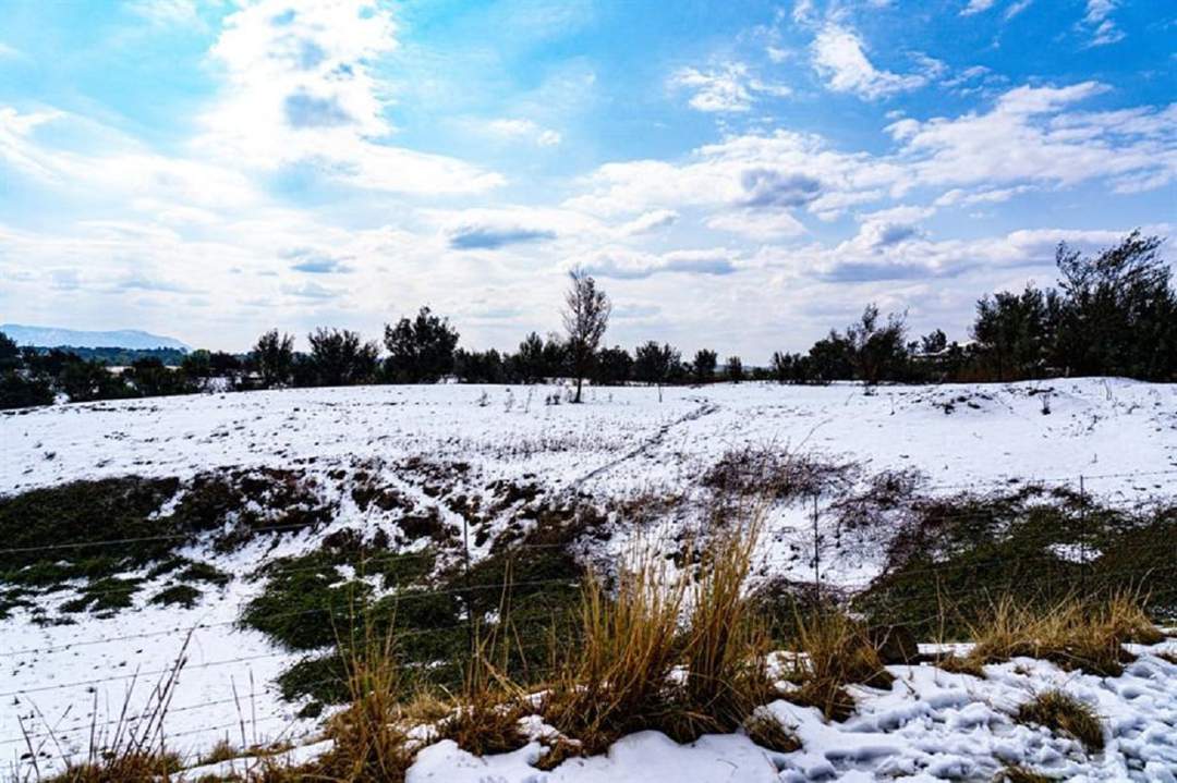
The weather service has forecast snow in parts of the Western Cape,Eastern Cape,and the Northern Cape.
Alfonso Nqunjana/News24
Strong winds and waves,disruptive snow and rain are forecast for parts of the Eastern Cape,Western Cape and the Northern Cape,according to the South African Weather Service (SAWS).
Yellow level 2: Damaging winds
Affected area: Eastern Cape
Validity period: 31 July to 1 August 2025#saws #weatheroutlook #southafricanweather pic.twitter.com/QOjaZSgxTr
— SA Weather Service (@SAWeatherServic) July 30,2025
- Damaging waves are forecast between Saldanha Bay and Cape Agulhas in the morning,spreading to Plettenberg Bay and Alexander Bay by afternoon; small vessels may be at risk of capsizing.
ADVERTISEMENT
Yellow level 2: Damaging waves
Affected area: Western Cape
Validity period: 31 July to 3 August 2025#saws #weatheroutlook #southafricanweather pic.twitter.com/RFRjDOmbWe
— SA Weather Service (@SAWeatherServic) July 30,2025
- Combined damaging winds and waves are expected between Plettenberg Bay and Port Edward,causing potential disruptions in harbours/ports and dangers to small vessels.
Yellow level 2: Damaging waves
Affected area: Eastern Cape (East coast)
Validity period: 31 July to 1 August 2025#saws #weatheroutlook #southafricanweather pic.twitter.com/xQQHWIlj0k
— SA Weather Service (@SAWeatherServic) July 30,2025
- Disruptive snow reported in high-lying areas between Graaff-Reinet and Komani,likely icing roads and disrupting mountain passes.
ADVERTISEMENT
Yellow level 1: Disruptive snow
Affected area: Eastern Cape
Validity period: 31 July 2025#saws #weatheroutlook #southafricanweather pic.twitter.com/Rdu9ZRrdjq
— SA Weather Service (@SAWeatherServic) July 30,2025
In the SAWS’ colour-coded weather warning system,yellow indicates a moderate risk of impact that requires caution and awareness,while orange indicates that higher-risk impact is expected,requiring increased attention and preparation.
SAWS uses the numbers to indicate the likelihood of weather-based impacts occurring. Levels 2 and 6 are high,and Level 4 is low.
Weather advisory: Very cold,wet & windy conditions. Affected area: Western & Northern Cape
Validity period: 31 July 2025.#saws #weatheroutlook #southafricanweather pic.twitter.com/0tbsW5h0jp
— SA Weather Service (@SAWeatherServic) July 30,2025
Pretoria: 3°C — 21°C
Johannesburg: 2°C — 20°C
Vereeniging: 2°C — 21°C
Mpumalanga: Fine,cool to cold conditions,but warmer in the Lowveld.
Mbombela: 5°C — 22°C
Ermelo: 2°C — 19°C
Emalahleni: 4°C — 19°C
Standerton: 5°C — 20°C
Skukuza: 3°C — 27°C
Limpopo: Fine with cool to warm conditions.
Polokwane: 1°C — 22°C
Phalaborwa: 5°C — 24°C
Tzaneen: 3°C — 24°C
Musina: 6°C — 26°C
Lephalale: 3°C — 22°C
Mokopane: 4°C — 22°C
North West: Fine,windy and cool weather expected.
Klerksdorp: 4°C — 22°C
Potchefstroom: 4°C — 21°C
Mahikeng: 5°C — 21°C
Rustenburg: 5°C — 21°C
Vryburg: 5°C — 22°C
Free State: Fine,windy and cold to cool,becoming partly cloudy in the southern parts.
Bloemfontein: 5°C — 21°C
Welkom: 5°C — 21°C
Bethlehem: 3°C — 18°C
Northern Cape: Cloudy and cold to cool with isolated showers and rain in the south and west. Scattered rain in the south-west where it will be very cold. Light snowfall may occur in the extreme southern regions. Coastal winds: Moderate to fresh north-westerly,becoming south to south-westerly.
Upington: 10°C — 17°C
Kimberley: 7°C — 22°C
De Aar: 8°C — 15°C
Alexander Bay: 12°C — 19°C
Springbok: 7°C — 12°C
Calvinia: 7°C — 10°C
Sutherland: 3°C — 7°C
Western Cape: Windy,cold and cloudy with widespread showers and rain. Snow is possible over mountain peaks. Conditions will clear from the north during the evening. Coastal winds: Strong to near-gale north-westerly in the south-west early on,turning westerly to south-westerly later.
Cape Town: 11°C — 14°C
Vredendal: 11°C — 15°C
Riversdale: 9°C — 14°C
George: 11°C — 15°C
Worcester: 10°C — 14°C
Beaufort West: 7°C — 15°C
Oudtshoorn: 7°C — 16°C
Western half of the Eastern Cape: Partly cloudy,becoming cloudy and cold with isolated showers in the afternoon,scattered near the coast. Light snow expected on coastal mountains and Sneeuberg. Coastal winds: Fresh to strong south-westerly,reaching gale force in the afternoon.
Eastern half of the Eastern Cape: Fine and warm,cooling over high ground. Cloudy conditions with evening showers expected in the west,alongside snowfall over Winterberg and Eastern Cape Drakensberg. Coastal winds: Moderate north-westerly,becoming fresh to strong south-westerly later.
ADVERTISEMENT
Gqeberha: 9°C — 16°C
Makhanda: 12°C — 19°C
Cradock: 8°C — 17°C
Graaff-Reinet: 7°C — 15°C
East London: 16°C — 25°C
Port St Johns: 13°C — 28°C
Mthatha: 9°C — 24°C
Komani: 7°C — 20°C
Qonce: 13°C — 25°C
KwaZulu-Natal: Fine,cool to warm conditions,turning cloudy in the south by evening with isolated showers and rain in the far south. Coastal winds: Moderate to fresh northerly to north-easterly.
Durban: 11°C — 25°C
Richards Bay: 13°C — 27°C
Pietermaritzburg: 6°C — 29°C
Ladysmith: 5°C — 25°C
*This weather report was written with the support of Toqan AI.
United News - unews.co.za