
People enjoying the afternoon sunshine in St James’s Park,London yesterday,when the UK saw its warmest start to May on record (Picture: 2025 James D. Morgan)
After the hottest start to May on record,temperatures are set to drop significantly,just in time for the bank holiday weekend.
People have been basking in unusually warm and sunny weather across the country over the past few days.
Yesterday saw a UK record-breaking May 1 temperature of 29.3C recorded at London’s Kew Gardens.
In Cardiff,meanwhile,it reached 27.4C,a record high for Wales,while cities in northern England saw temperatures of around 23/24C.
Today is milder,but highs in London are expected to reach 24C still.
The drop,however,is set to continue tomorrow,with 21C forecast for London,and 19C in Manchester.
There may be some showers,especially in the far north and far south,but it will be mostly dry with sunny spells.
On Sunday,temperatures will fall to as low as 9C in Scotland,10/11C in northern England and Northern Ireland and 12/13 in the south east- just below average for this time of year.
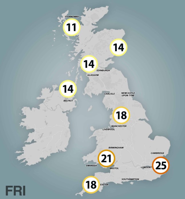
Friday is still relatively warm

Saturday is a little milder
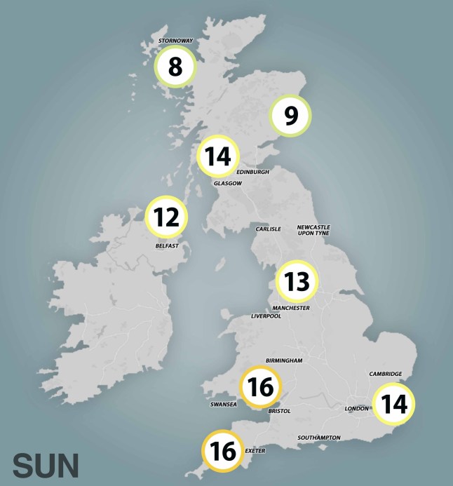
The temperature drops significantly on Sunday
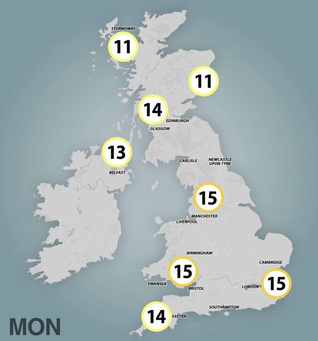
Things get a touch warmer on Monday
The warmest parts of the UK on Sunday,according to Met Office predictions,will be Wales and the south west,where temperatures are expected to reach 16C.
To get the latest news from the capital visit Metro's London news hub.
Things warm up a bit on Monday – though don’t get too excited,we’re talking one or two degrees.
However,the good news is all three days should be pretty dry for the most part,with regular bursts of sunshine.
The rain is due to stay away for most of next week too for many parts of the UK.
Temperatures,are forecast to steadily rise,peaking at around 18C in the south and 17C in the north next weekend.
United News - unews.co.za